|

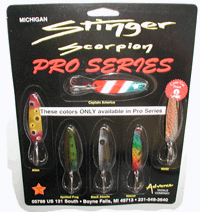
Scorpion Stinger Spoons

Lake Erie Fishing
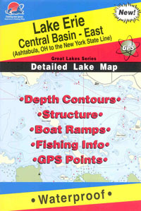
Maps

The Official Walleye.com
Lake Erie Walleye
Fishing Hat
|
Walleye Fact File
Dead Zone Update
Lake Erie Again Battling Areas of Hypoxia
Lake Erie's dead zone has returned again this summer according to new
research in Lake Erie's Central Basin. During a six-day survey in
mid-August, scientists on US.EPA's Lake Guardian, found that only 20
percent of monitoring stations had the desired amount of four milligrams per
liter (mg/L) of dissolved oxygen in the water. Forty percent of the stations
showed less than half that amount. The lowest oxygen concentrations were
discovered in the western portion of the Central Basin, where concentrations
dropped to .7 mg/L.
Over the last two years, Lake Erie has experienced dead zones or areas of
anoxia, where oxygen levels in thelake are too low for fish and other
aquatic species to survive. Dissolved oxygen concentrations less than 2 mg/L
are considered hypoxic and can threaten aquatic life that cannot move from
the area.
The key is the amount of phosphorus that goes into the Lake, says Ohio
Sea Grant researcher, Dr. David Culver. "The smaller the amount of
phosphorus discharged into the lake, the less likely we will have a dead
zone."
Unfortunately, even with regulations in place, phosphorus concentrations
have been increasing since 1995. "Scientists are beginning to suspect that
they might have underestimated the amount of phosphorus still entering the
lake from sewage treatment and agricultural runoff," says Jeffrey Reutter,
Director of Ohio Sea Grant and Stone Lab. "High levels of phosphorus
increase the growth of algae, which in turn, increases the rate of oxygen
consumption."
While phosphorus levels may be the key, other factors influence the
magnitude of the dead zones. Lake Erie is functioning with less water due in
part to global warming and falling water levels. The thickness and volume of
the hypolimnion is reduced as water levels drop, resulting in less available
oxygen. Thus, if water levels continue to decline, the anoxic area may cover
less of the lake's bottom, but arrive earlier and last longer each year.
Another suspect of the Lake's dead zone may be the invasive zebra and
quagga mussels. Early research results indicate that as mussels process
organic matter, they excrete phosphorus into the water where it is
repeatedly used instead of going into the sediments.
Predictions for next year are not encouraging. "Lake Erie has had quite
an eventful summer this year," says Culver. It was first pounded by 10
inches of extra rainfall, 30 percent above its average. Then, the largest
power outage in the US resulted in millions of gallons of raw sewage
discharged into the lake and its tributaries. And at the same time, the
western basin saw a growth of algal bloom, one of the largest in recent
years. "These large nutrient inputs may mean next year's dead zone will
develop earlier," emphasizes Culver.
Its severity, however, will depend on the amount of wind the lake will
get in the spring. If the spring is extremely windy, the wave action will
cause the warmer upper water layer (epilimnion) to mix heavily with the
lower cooler layer (hypolimnion), resulting in a deeper thermocline. The
deeper thermocline will mean a smaller volume of oxygen in the hypolimnion
and an earlier dead zone.
For more details about the dead zone, request the dead zone excerpt in
Highlighted Publications (page 2) or go to the 2002 Sept/Oct issue of
Twine Line at www.sg.ohio-state.edu.
This article is reprinted from the September/October,
2003 issue of Twine Line, a publication of Ohio Sea Grant.
Steelhead Trout: A Money Fish for
Ohio
Research Finds Steelhead Angling Beneficial to Anglers and Economy
Steelhead trout have been stocked into Lake Erie tributary streams since
1975 through a very successful program administered by the Ohio Department
of Natural Resources, Division of Wildlife. The success of the program has
grown over the years, resulting in increased stocking numbers and the
addition of more streams. During 2003, over 400,000 steelhead smolts were
stocked in five Lake Erie tributaries. This program provides Central Basin
anglers with the opportunity to catch trophy class rainbow trout (steelhead)
during the summer months in the open waters of Lake Erie, and in tributary
streams during the fall, winter, and spring months. Over 98 percent of
steelhead are caught are in Ohio's two lake districts (#2 and #3) that
stretch from Huron to Conneaut.
Creel data is collected annually by the ODNR Division of Wildlife to
assess open lake steelhead angler success. During 2002, private and charter
boat anglers caught approximately 41,357 steelhead in the open lake; an
increase of over 41 % compared to 2001, and the highest on record since the
program began. When compared to past years harvest (1995 = 3,500 and 1997 =
4,000) the increased stocking has resulted in a significant benefit to
angler harvest. Unfortunately, very little is known about the harvest of
steelhead from tributaries.
To learn more about this steelhead stream fishery, Ohio Sea Grant
initiated a research effort to survey these anglers during the 2002-2003
tributary angling season. This is the first time an economic survey of Ohio
Lake Erie steelhead stream anglers has been conducted. While the state of
Ohio and other Great Lakes states have intensive management programs aimed
at enhancing the steelhead fishing experience for anglers, little is known
about the tastes, preferences, and values of Ohio steelhead anglers
From October 2002 through April 2003, Ohio Sea Grant personnel contacted
anglers at popular streamside locations (from Vermilion to Conneaut) seeking
their participation in a survey to better understand steelhead angler
fishing habits, economic expenditures, and angling/visitation needs. Anglers
were asked basic creel data questions and were also asked to participate in
a mail survey related to the day of contact and other seasonal angling
questions. Overall, 487 anglers were contacted for survey participation,
with 375 surveys returned.
Within the steelhead fishery, most anglers (94%) appear to take
single-day trips. Due to the low number of respondents for multiple-day
trips, the study has focused on single-day trips. Respondents on single-day
trips indicated taking an average of 44 steelhead fishing trips per year.
About 72% of the trips individuals take are taken to the site where
individuals were intercepted. Most trips are taken in fall of 2002 and
spring of 2003, with a smaller proportion taken in winter. This was largely
because most, if not all of the prime steelhead fishing streams were frozen
solid and unfishable in most of January, February, and much of March 2003.
Anglers indicate that they keep approximately 12% ofthe fish that they
catch (7.1 fish kept vs 58.4 fish caught), and that they eat approximately
49% of the fish they kept (3.5 fish eaten vs 7.1 steelhead kept). Anglers
catching relatively few steelhead tend to keep a higher percentage of the
fish they catch than anglers who catch large amounts of steelhead.
The survey did not consider other types of fishing in which the
individuals potentially engage, but it does provide information on the way
individuals fish for steelhead. Approximately 65% of steelhead anglers spin
cast with bait or artificial lures while a smaller proportion fly fish
(30%). The average angler surveyed had 9.0 years experience fishing for
steelhead.
Individuals responded that they spend approximately $26 per trip, with
more than 60% of these expenditures within 10 miles of the sites where they
are fishing, suggesting that each trip generates nearly $16 in local
expenditures. For just the 311 _: visitors in our single trip angler sample,
taking 44 trips per year on average, this generates $218,000 in annual
expenditures locally on steelhead fishing. It is not possible,
unfortunately, to extrapolate the expenditure values to all steelhead
anglers since the sampling protocol provides no information on the
proportion of the total population that fishes for steelhead. However, if as
many as one percent of the 754,704 licensed resident anglers in Ohio in 2001
fished for steelhead this would give us a total of 7,547 anglers x 44 trips
x $26 = $8.6 million.
The study explored the factors that affect steelhead catch rates and the
value of steelhead fishing in tributaries to Ohio's portion of Lake Erie.
Overall, the results suggest that steelhead fishing is a very valuable
activity in Ohio. The travel cost model used estimated that the value per
trip for anglers taking part in our study ranged from $36 to $50.
The study results also made it possible to consider the value of a single
fish caught. On average, individuals in the sample catch 1.33 fish per trip.
This suggests that the value of each fish caught ranges from $27 to $38 per
fish. Over all fish caught by the anglers in just our survey (approximately
20,323), the estimated value of catching fish is $591,300 to $832,200. In
2002, ODNR Division of Wildlife stocked 411,601 fish, for a cost of
approximately $590,000 per year. These results do not fully capture all
benefits of the stocking program, but suggest that the benefits of stocking
do outweigh the costs.
While these results suggest that steelhead angling is highly valued by a
segment of anglers in Ohio, we cannot fully estimate the benefits for all
Ohioans from the limited sample collected. In the future, more thorough data
collection would provide information on other anglers who fish for steelhead
less frequently. Further, it would be useful to have independently collected
creel data to assist in benefit cost analysis of the stocking program.
Finally, the results of the survey suggested strong differences in seasonal
trips, and access to a variety of sites. Further evaluation of the timing of
trips and access could provide additional useful information.
This article reprinted from the November/December 2003 issue of Twineline,
a publication of Ohio Sea Grant and was authored by Dave Kelch & Frank
Lichtkoppler, Ohio Sea Grant Extension; and Brent Sohngen & Adam Diagneault,
Ohio State University. |


