The Big Picture
by Ron Anlauf
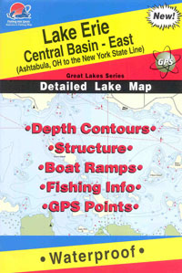
One of the biggest breakthroughs in modern walleye fishing has
been the introduction o f
highly detailed contour maps. The new maps have revealed a wealth of
information including some of the secret hot spots that only a handfull
of anglers knew about, that is until now. Now you can see the
spots; the breaks, the sunken humps, the inside turns, etc., and all of
it with eye opening detail. Even anglers quite familiar with a
particular body of water can learn something new from a high definition
map, especially when it comes to larger bodies of water.
The key to getting the most out of what's available now is
learning to actually read the maps and is an important element of
successful walleye angling. Even if it's right in front of you in
brilliant living color it really won't help unless you know what to look
for. Proficient map readers can take a look at a map and quickly narrow
down the potential hangouts which allows themto spend more time fishing
in areas that have a high chance of producing. Spending more time in
likely areas is a matter of efficiency and is the key to getting the
most out of a situation.
Finding likely looking areas requires more than a simple once
over look at a map, as there are other factors that must be first
considered. Factors like seasonal movements and water clarity can have a
major effect on walleye location and must be take into consideration
when trying to put it all together. Seasonal movements include a
shallow, to deep, to shallow migration that spans the open water season.
That progression may be altered by other factors like dark or dirty
water which might completely eliminate the deep water option. Dark or
dirty water can keep walleyes shallow all season long and greatly reduce
the number of deeper options, and potential holding areas. On the other
hand while dark water can reduce the deep water options, it may also
increase the number of shallow water areas that could be holding fish.
After you’ve determined seasonal and clarity conditions you can
then take a look at a map and try to find areas that might fit the bill.
If you’re looking for early season hot spots try to locate shallower
bars, reefs, and maybe even flats. A flat will look like a widening of
contour lines where there's no change in depth. A bar or reef will look
like a flat surrounded by contour lines that pull in tight to each
other. If we're already into the summer period look for deeper structure
like underwater points and humps and if we're heading into the fall you
may need to find a combination of the two.
A contour line is simply a constant depth reading that can
reveal the presence of structure, or the lack thereof. Following a
contour line will also reveal the shape and characteristics of the
bottom and give you a rather rough picture of what’s down below. Contour
lines that pull tight together indicate a fast change in depth while
wider lines suggest more of a slope, or slow drop. The absence of a
contour line indicates a constant depth or flat. Fast drops are usually
associated with a hard bottom while slower drops may or may not indicate
a softer bottom.
As good as the new maps can be there still may be something too
small to be included and it might take a little investigation to find
it's whereabouts. Omitted secondary structure has a good chance of being
a top producer simply because it will probably receive less pressure
than the more obvious. A clue to finding overlooked secondary structure
may be hidden in a tiny variation in a contour line. Follow out the
lines and look for a slight turn out or in, and keep it in your memory
bank untilyou can take a look for yourself with a graph or depth finder.
When working from a map on a new lake it would be a good idea to
first get familiar with the major and more obvious structure before
looking for the secondary spots. By working over the major areas first
you can get an idea of how and where fish are relating to it and will
give you an idea of what to look for in a secondary spot.
Finding structure by way of a contour map alone takes a lot of
effort and can be especially trying when you get miles offshore.
Shoreline structure is a whole lot easier to locate as you can key off
of major points, public accesses, roads etc. Once you move away from
shore you’ll have to utilize a combination of those same landmarks and
combine it with your depthfinder. The quickest way to finding
offshore structure includes the use of a Global Positioning System that
will display the high definition maps, like the Humminbird 937C. The
937C is a color graph/GPS plotter combination that has a wide screen
with more than enough room to display both the plotter and the graph at
the same time. The combination allows you to see exactly where you are
on the plotter while looking for fish, bait, weeds, etc.on the graph.
What you'll find if you're using accurate maps like the Navionics Hot
Maps is that struture is where it's supposed to be, and changes in depth
occur right where the map indicates it. If it all sounds complicated it
really isn't. The Navionics maps are pre-loaded on a chip that is simply
plugged into the unit and then displayed on the plotter. From there it's
up to you. See you on the water.


 f
highly detailed contour maps. The new maps have revealed a wealth of
information including some of the secret hot spots that only a handfull
of anglers knew about, that is until now. Now you can see the
spots; the breaks, the sunken humps, the inside turns, etc., and all of
it with eye opening detail. Even anglers quite familiar with a
particular body of water can learn something new from a high definition
map, especially when it comes to larger bodies of water.